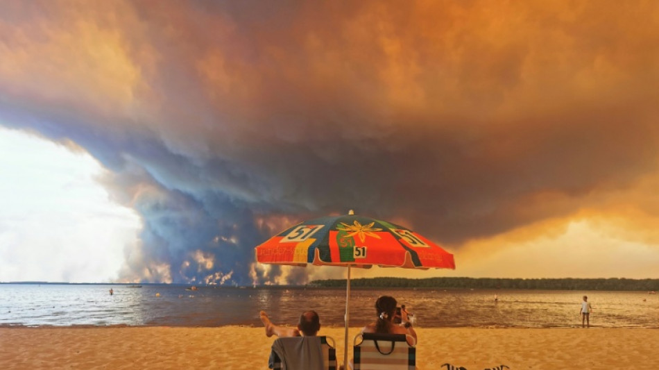
What are 'fire clouds', the ominous phenomenon seen in France? / Photo: © AFP/File
Firefighters battling devastating fires in France have had to contend with a new threat: immense fire clouds that create their own wind and even lightning that can spark fresh blazes.
Known as "fire clouds" or pyrocumulonimbus clouds, these ominous-looking thunderstorms are created by extreme wildfires and can exacerbate already extremely dangerous conditions.
This phenomenon, which is new to France, is yet another consequence of human-caused climate change, according to French researcher Jean-Baptiste Filippi, who studies wildfires.
As firefighters in southwest France struggle to bring a forest inferno under control before yet another heatwave descends on the country, Filippi told AFP about the phenomenon.
- What is a fire cloud? -
It starts off as a cute little white cloud -- a cumulus cloud, which is formed because water vapour has turned into tiny droplets.
As the Sun heats the ground, the water vapour suddenly condenses. The cumulus becomes a much larger cloud, containing thousands of tonnes of suspended water.
Then, when the surrounding air has become heated enough, it forms a column with an anvil-shaped cloud -- the cumulonimbus.
This condenses even more air and generates more energy, with updrafts of more than 150 kilometres (90 miles) an hour.
It then rains, but the rain evaporates before it reaches the ground.
But it still cools the atmosphere where it falls, creating strong downdrafts.
- Are fire clouds rare? -
It is a common phenomenon in Portugal, California and Australia, where firefighters are more used to them. In Portugal, they had been rare until the deadly 2017 fires in Pedrogao Grande changed things.
In France, pyrocumulonimbus clouds are quite new. There were some in Landiras south of Bordeaux in 2022, but not for long.
Therefore, we need to learn how to manage fires that creates their own wind -- this is something relatively new.
- Is climate change to blame? -
Yes, it is. A consequence of global warming is more frequent heatwaves. While thunderstorms are common in the region of this fire, thunderstorm conditions after three successive heatwaves is a new combination.
- Are they predictable? -
Weather services can predict thunderstorms. But because these storms are located directly above a fire, we would need to know the fire's exact location in advance. That's impossible.
We can predict the conditions that will lead to these fires, but we won't know exactly where they are.
The biggest challenge is how unpredictable they are. The fire in France's southwest Gironde region started with northerly winds, then westerly, then southerly, then easterly, then back again to the south, then the west...
On top of that, there is this potential energy in the atmosphere which meant that, locally, the convection column sucked up the embers and carried the fire further afield.
The local conditions became catastrophic and the rate of the fire's spread was staggering.
K.al-Ansari--BT